[4] Identification of spatiotemporal patterns of biophysical droughts in semi-arid region – a case study of the Karkheh river basin in Iran
Abstract
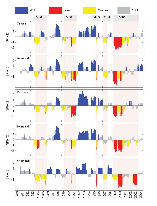
This study aims at identifying historical patterns of meteorological, hydrological, and agricultural (inclusively biophysical) droughts in the Karkheh River Basin (KRB), one of the nine benchmark watersheds of the CGIAR Challenge Program on Water and Food. Standardized precipitation index, standardized runoff index, and soil moisture deficit index were used to represent the above three types of droughts, respectively. The three drought indices were compared across temporal and spatial dimensions. Variables required for calculating the indices were obtained from the Soil and Water Assessment Tool (SWAT) constructed for the region. The model was calibrated 10 based on monthly runoff and yearly wheat yield using the Sequential Uncertainty Fitting (SUFI-2) algorithm. Five meteorological drought events were identified in the studied period (1980–2004), of which four corresponded with the hydrological droughts with 1-3 month lag. The meteorological droughts corresponded well with the agricultural droughts during dry months (May–August), while the latter lasted for a longer period 15 of time. Analysis of drought patterns showed that southern parts of the catchment were more prone to agricultural drought, while less influenced by hydrological drought.