[6] Multilevel drought hazard assessment under climate change scenarios in semi-arid regions - a case study of the Karkheh River basin in Iran
Abstract
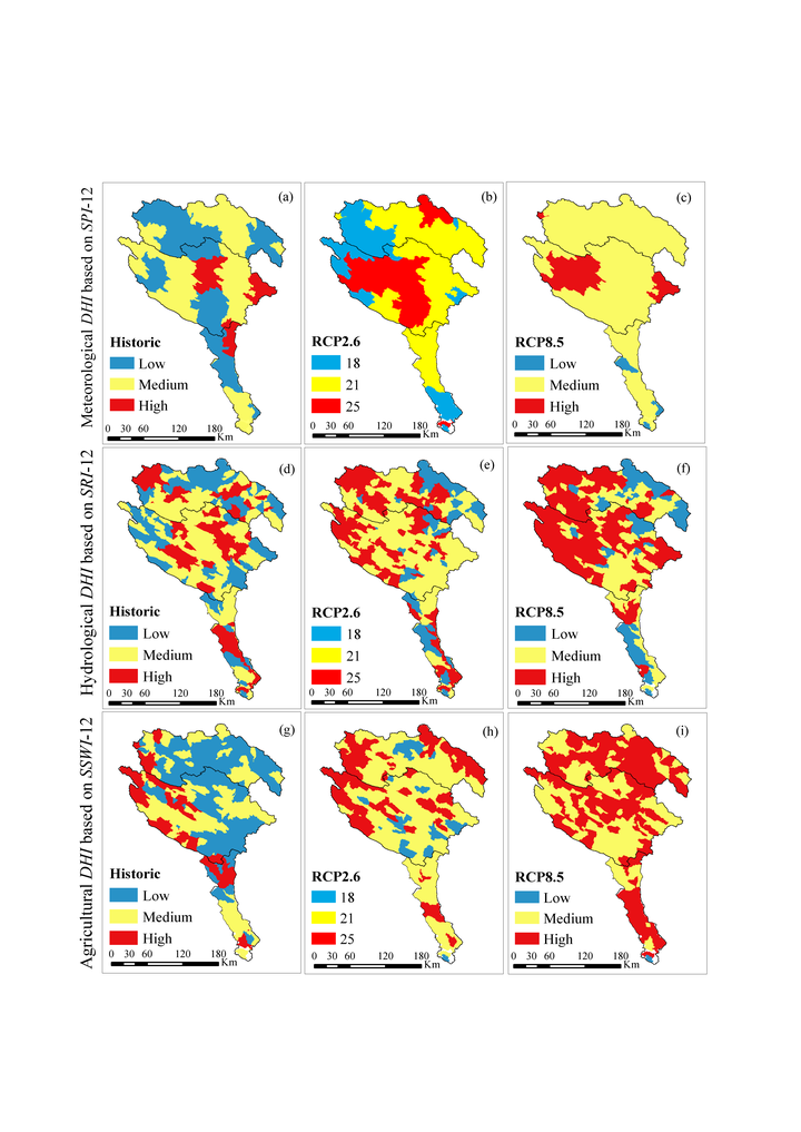
Studies using Drought Hazard Indices (DHIs) have been performed at various scales, but few studies associated DHIs of different drought types with climate change scenarios. To highlight the regional differences in droughts at meteorological, hydrological, and agricultural levels, we utilized historic and future DHIs derived from the Standardized Precipitation Index (SPI), Standardized Runoff Index (SRI), and Standardized Soil Water Index (SSWI), respectively. To calculate SPI, SRI, and SSWI, we used a calibrated Soil and Water Assessment Tool (SWAT) for the Karkheh River Basin (KRB) in Iran. Five bias-corrected Global Circulation Models (GCMs) under two Intergovernmental Panel on Climate Change (IPCC) scenarios projected future climate. For each drought type, we aggregated drought severity and occurrence probability rate of each index into a unique DHI. Five historic droughts were identified with different characteristics in each type. Future projections indicated a higher probability of severe and extreme drought intensities for all three types. The duration and frequency of droughts were predicted to decrease in precipitation-based SPI. However, due to the impact of rising temperature, the duration and frequency of SRI and SSWI were predicted to intensify. The DHI maps of KRB illustrated the highest agricultural drought exposures. Our analyses provide a comprehensive way to monitor multilevel droughts complementing the existing approaches.